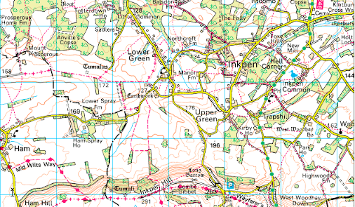
How to use the maps
We've switched from OS online maps to Google maps. In this section there's a little explanation of how to use these.
Learn more
five beautiful walks around inkpen
Located in the North Wessex Downs Area of Outstanding Natural
Beauty (AONB), Inkpen offers a variety of walking environments
including high chalk ridges, mixed farmland and deciduous
woodland.
The five circular walks described here each has a different
character and between them they cover the best routes and key
landmarks in and around Inkpen. They each start/finish at one of
Inkpen’s two pubs: The Crown & Garter and The Swan. They are
of various lengths and are intended for both visitors and
villagers alike. Some offer long distance views in all directions
from high chalk hills, others pass through tranquil woodland in
the valley. Wildlife of all kinds is plentiful and readily seen.
The character of these walks also changes with the seasons thereby
providing year-round variety and enjoyment.
Rights of way in Inkpen are overseen by the voluntary Inkpen
Rights of Way Committee (IRWC), which has also created these
walks.
These walks include family friendly walks as well as providing greater levels of challenge. Likewise, these may take between one and a quarter hours right up to five and a half hours. Each walk has an accompanying pdf file, together with gpx and kml files. Enjoy!
We've switched from OS online maps to Google maps. In this section there's a little explanation of how to use these.
Learn more
This is a walk of about 3.6 miles (5.8 Km) and should take between 1.5 and 2.5 hrs. This is graded an easy walk with no stiles, but can be a little muddy.
Learn more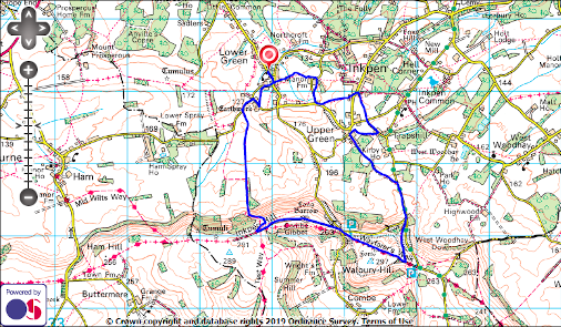
6.3 miles (10.2 Km) with a climb up to the chalk ridge to the south of Inkpen. Allow 2 to 3 hrs. There are stiles and some mud in wet weather.
Learn more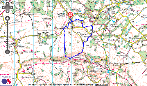
This is a shortened version of walk 2, just 4.4 miles (7 Km) and involves the ascent and descent of steep slopes. It has stiles and can be a little muddy.
Learn more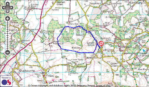
This is a fairly level walk of 4 miles (6.4 Km) expected to take 1.25 to 2 hrs. The section through Anvilles Copse is soft to muddy throughout the year.
Learn more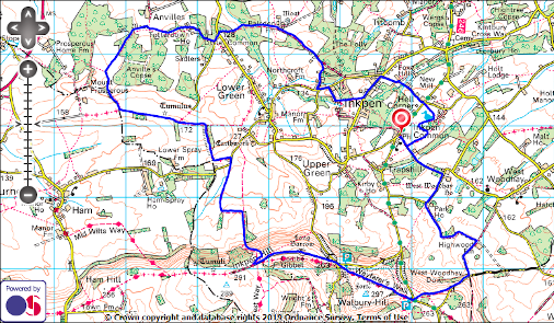
This is a long and fairly strenuous walk involving a steep descent including stiles. Going may be soft and even a little boggy. 11.3 miles (18.2 Km), about 3.5 to 5.5 hrs.
Learn moreThe Inkpen Rights of Way Committee (IRWC) was formed more than
30 years ago and comprises villagers who represent a variety of
interests such as horse riding, cycling, conservation and nature
study as well as walking. It also includes a Parish Council
representative to ensure good links between the two bodies.
The main purpose of the IRWC is to ensure that the 51 rights of
way in the village are clearly signposted and way-marked and are
maintained in a state which enables them to be used at all times
of the year (albeit with wellies). Inkpen is fortunate not just
in having so many paths but also in that, in general, local
landowners and occupiers are co-operative and respond positively
to suggestions for improvements and way-marking.
IRWC is also committed to increasing residents’ awareness of the
existence of Inkpen’s rights of way and promoting their use. It
is with this aim in mind that ‘Walks in and around Inkpen’ is
published on this website. We hope that you enjoy them.
| North Wessex AONB | http://www.northwessexdowns.org.uk/ |
| The Crown & Garter | http://www.crownandgarter.co.uk/ |
| geocaches | http://www.geocaching.com/ |
| OS MapFinder | https://www.ordnancesurvey.co.uk/shop/mapfinder |